This is an overview of my projects related to using geospatial technology and data science to analyse the impact of extreme weather on transport and improve resilience management and community safety.
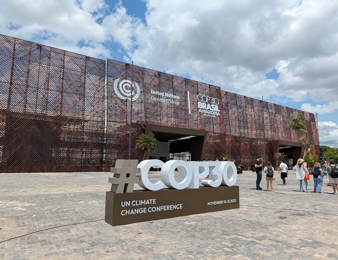
I attended COP30 in Belém as a Newcastle University Observer, following my participation in the University's Policy Academy.
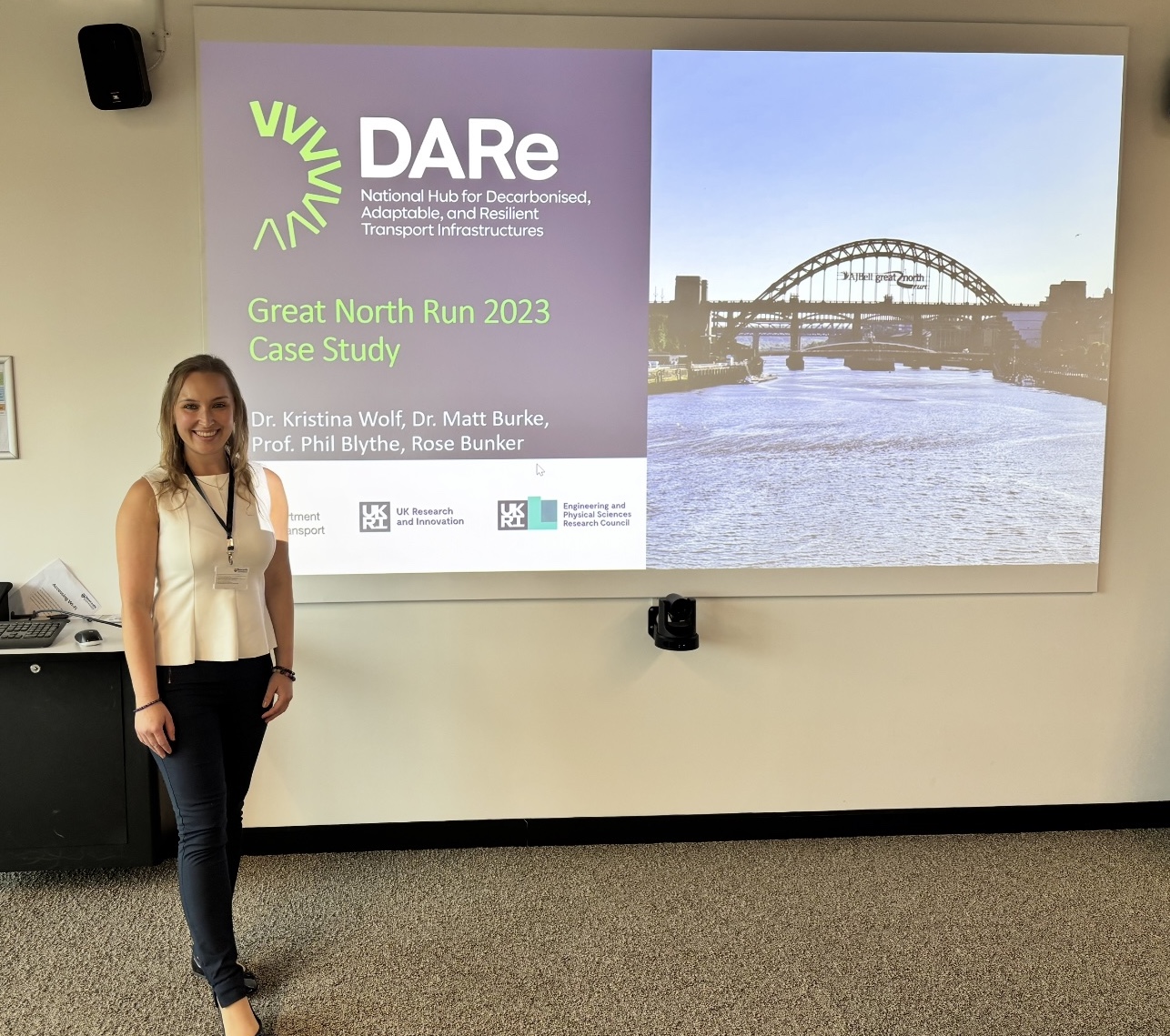
I led a case study on the world's largest half marathon, the Great North Run, which experienced extreme weather in 2023, impacting transport.
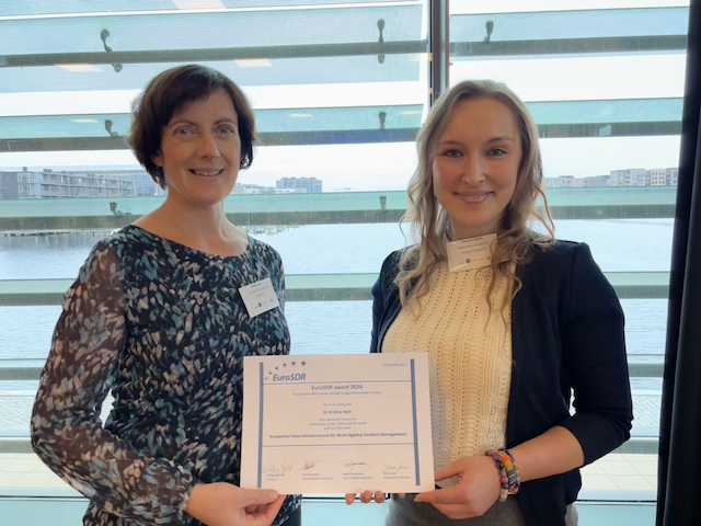
I was invited to present my PhD research at the Board of Delegates meeting in Copenhagen, Denmark.

I was invited as a keynote speaker to present my work how geospatial data infrastructure can support multi-agencies in incident management.

This project demonstrates how we can use AI-based computer vision algorithms and text generation to extract information about the impact of hazards from openly available images.

As part of my research visit at CURA at The Ohio State University, I gave a webinar in which I presented several use cases for integrating (near) real-time data for incident management.

Following a severe autumn storm, this work analyses the impact of heavy rainfall on the transport network, including travel time and traffic volume, using real-time data.

This project shows how the hazard maps currently available can be enhanced with real-time traffic data and social media tweets to provide a better picture for emergency services.

This project presents a multi-scale database for analysing the impacts of flooding on the environment, community and infrastructure in Newcastle (UK).
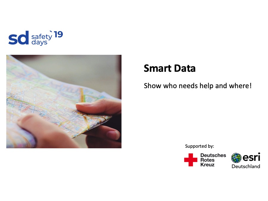
As part of a hackathon, my team developed an app for the German Red Cross containing publicly available data on vulnerabilities (e.g. demographic and socio-economic data) to support the German Red Cross in emergencies.
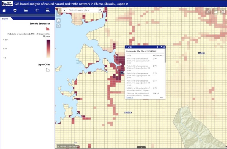
Using real-time data from probe vehicles in Japan, we analyse traffic behaviour during natural hazards compared to a normal day. The results are implemented in a GIS-based decision support tool.
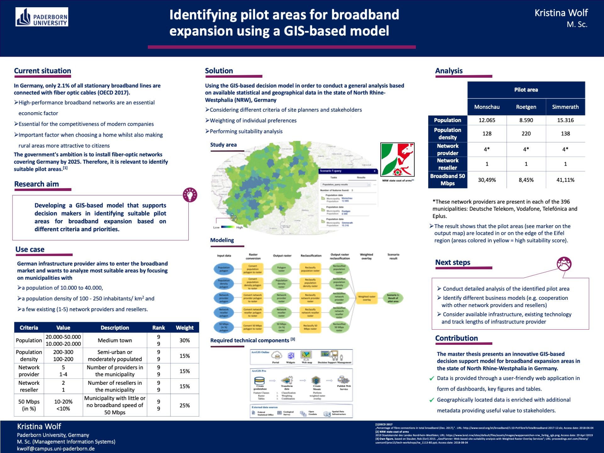
In the context of broadband expansion in Germany, I was involved in a project with an industry partner to identify expansion areas according to different criteria. The result is a GIS model for multi-criteria decision support.

Lorem ipsum dolor sit amet, consectetur adipisicing elit. Mollitia neque assumenda ipsam nihil, molestias magnam, recusandae quos quis inventore quisquam velit asperiores, vitae? Reprehenderit soluta, eos quod consequuntur itaque. Nam.

Lorem ipsum dolor sit amet, consectetur adipisicing elit. Mollitia neque assumenda ipsam nihil, molestias magnam, recusandae quos quis inventore quisquam velit asperiores, vitae? Reprehenderit soluta, eos quod consequuntur itaque. Nam.

Lorem ipsum dolor sit amet, consectetur adipisicing elit. Mollitia neque assumenda ipsam nihil, molestias magnam, recusandae quos quis inventore quisquam velit asperiores, vitae? Reprehenderit soluta, eos quod consequuntur itaque. Nam.

Lorem ipsum dolor sit amet, consectetur adipisicing elit. Mollitia neque assumenda ipsam nihil, molestias magnam, recusandae quos quis inventore quisquam velit asperiores, vitae? Reprehenderit soluta, eos quod consequuntur itaque. Nam.

Lorem ipsum dolor sit amet, consectetur adipisicing elit. Mollitia neque assumenda ipsam nihil, molestias magnam, recusandae quos quis inventore quisquam velit asperiores, vitae? Reprehenderit soluta, eos quod consequuntur itaque. Nam.

Lorem ipsum dolor sit amet, consectetur adipisicing elit. Mollitia neque assumenda ipsam nihil, molestias magnam, recusandae quos quis inventore quisquam velit asperiores, vitae? Reprehenderit soluta, eos quod consequuntur itaque. Nam.